Twelve Hours - 97 Snapshots...
We were on the road from 8am until 8pm yesterday (counting or not counting Pacific Time w/ Daylight Savings or without - timing is pretty confusing as some states do DST and some don't and some of the Reservations do the opposite of the state. It's every o'clock in 4 corners.
Nonetheless, we started out early after a weird night's sleep. I woke up in the middle of the night and initially I thought the woman in the trailer next door was being murdered. It turns out that Coyote howls really do sound like a screaming woman - you know it's a Coyote, because no human would sustain a scream that long!
So, we got back to sleep, but were up early anyway - as Marge said, "I'm itchin' to get back to the RIM..." Okay. So, we headed back up to the South Rim entrance - going through another 20 miles of treacherous (NOT) Elk country, resplendant with warnings but no large mammals. At the South Rim, this time we headed easterly, to the aptly named, East Entrance.
This drive was a lovely vista filled experience, but once again our Park Service let us down as the signage was poor, and the overlooks didn't give much notice!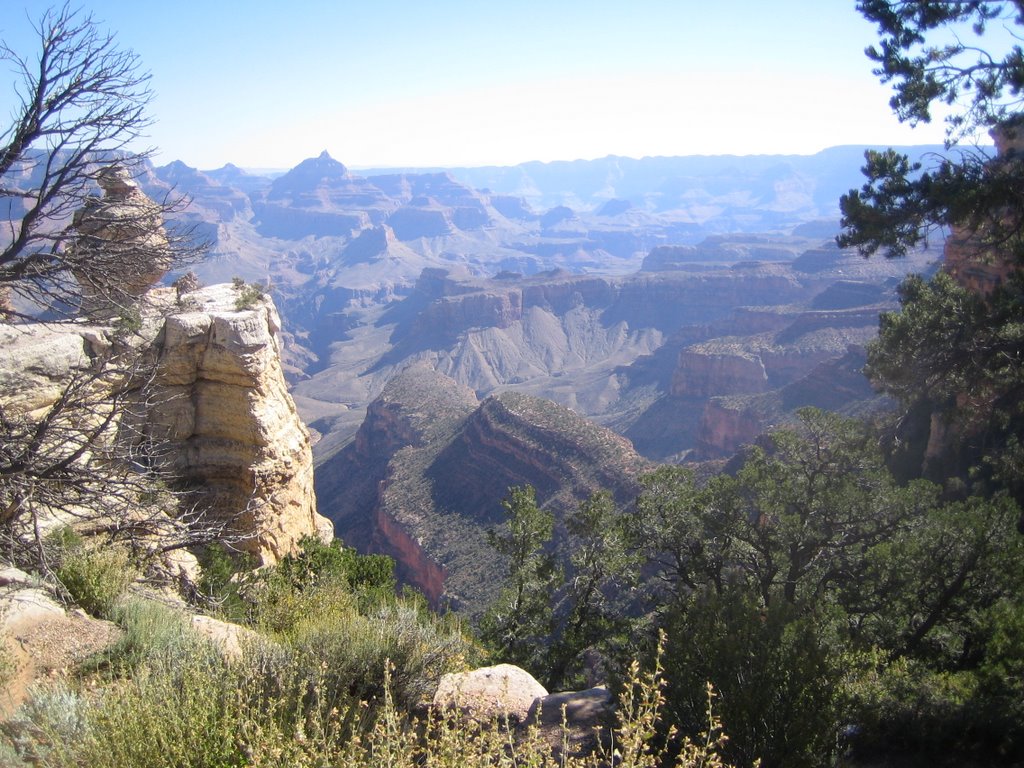
We stopped a few times, at Grandview Point, Moran Point and then a really interesting little non-rim adventure, the Tusayan Ruins and Museum. This is part of the Canyon Park; it's the ruins of a small Puebloan community from around 850 years ago, probably only 25 to 30 folks lived here. 
The ruins were well shown, left to be but also clearly signed and the story was told. They did a bit of speculation, like walking down a path to a wash and saying that "corn might have been grown here". Overall, it was worth the side trip.
Onward, we went to Navajo Point, and from there could see Desert View, the stone tower that marks the East Entrance to the Park. We headed over to Desert View, where the view was massively impressive.
From this vantage point, you get Canyon on three sides of you, at the tip of a promontory, from the top of the tower - NICE. 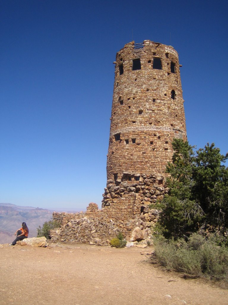 They also have these really cool 'black mirrors' which reflect the canyons but completely cut the glare so that you really see all of the colors...
Crowded was the only bummer. It wasn't easy for us getting around, or parking, or having a nice quiet experience.
I cannot even begin to imagine what it is like here in high season.
We had spent about half the day, but only gone about 60 miles, so with a lot of driving left to us, we headed out and back south to I-40.
This took us right near Wupatki National Monument, which I saw about 18 years ago and loved; so I suggested we take that Park Loop road - always beautiful, always super slow - and check out the ruins there.
The first stop was the Citadel, a pretty incredible hilltop fortress with 8 small Pueblo community ruins in view. 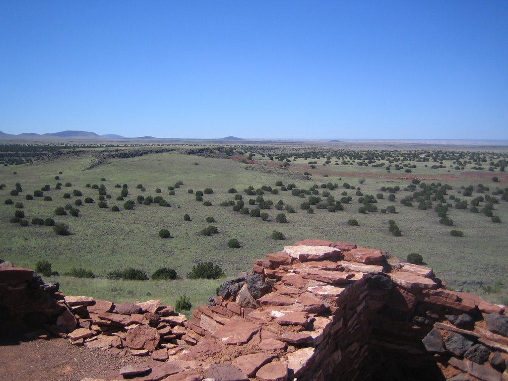
The land here is really different; there was a volcanic eruption (we'll get to that later) around 900 years ago, and the layer of volcanic ash made the area fertile and able to retain more moisture. That allowed for a large influx of farmers and the development of more elaborate Pueblos.
Wupatki is the disputed name of the main Pueblo, they estimate at one point up to 100 people lived and worked in this 3 story dwelling which is very cleverly built on and around a small butte. 

The crazy thing is that the culture is still a matter of debate amongst the anthro- and archaeo-logists; there are over 100 different pottery styles in situ, and the amount of trade they were doing was incredible.
Even wilder, they have a full-on South/Meso-american ball court there, which is basically unheard of in the southwest. Pretty cool. 
Adjacent to the ballcourt is another incredible thing; a natural feature called a blowhole. It's a large sink or cavern with a small opening to the surface.
Because of the difference in air pressure, either air dramatically sinks into it; or - as was the case in the 95 degree full on sun of yesterday, chilly air blows out of the ground. Check out Marge's hair! 
Well, now we were really behind, but we had a great time and it was worth it. We continued on the Park loop, which also takes you through Sunset Crater. Remember I said a volcano erupted about 900 years ago - well, this is it and it's about 10 miles away.
You can't hike the crater, and the landscape is pretty fragile, as in they don't want you walking around, so we just kept moving. There are some beautiful lava flows around the cindercone, and it's in places just like a moonscape. Well worth the whole side trip.
Back onto 40, for another 3.5 to 4 hours of driving, and sadly, all East. Because we were facing so much time on the road, we had to pass up both Meteor Crater and The Petrified Forest, although they do have a lot of petrified logs along the side of the highway, so you get a good taste. Also not a lot of time to stop at all the Trading Posts and check them out.
Sidebar: if the Pope admits he is wrong, what does that say about Papal Infallability and thenafter, which is right and which is wrong? The infallability or the Pope...
Also, trivia question for Catholics, who was the last Grand Inquisitioner, if that title was still in use today... A hint would tell you that the Inquisition was still called that into the last century and after a bit of euphamizing, became the Congregation for the Doctrine of the Faith - check it out... http://en.wikipedia.org/wiki/Congregation_for_the_Doctrine_of_the_Faith
Back to the road. We set our sights on Grants, NM, and made it there an hour after dusk. We got a great site and other than the chain-smoking emphesema victims next door, had a nice night. We tried out our new "glow in the dark star chart", but with the combination of the lights around us and the chart definitely not glowing, we just enjoyed a nice night sky rather than identifying much of anything. It was a pleasant way to end a big day, after that we passed right out. We are looking at another 8 or so straight hours of driving to hit Oklahoma City by tonight.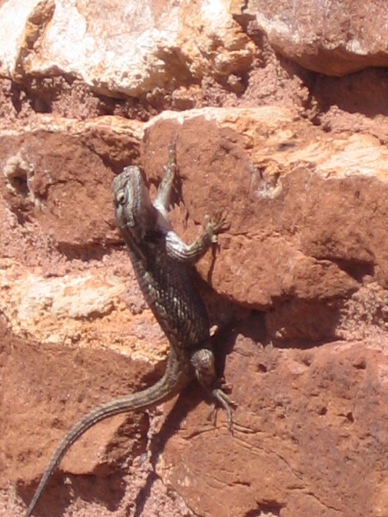
Fuel: really just stopped to clean the windshield
181 miles
21.941 gallons
$65.80
2.999/gallon
8.25 mpg - pretty good, but lots of slow and steady.
Roadkill:
Coyote - hung on a fence (I've heard they do this because they think it scares the others away)
Coyote
Indiscriminate lumps - lots
8 pounds of insects on our windshield
Live:
Hawk - not specific
Chipmunk
Squirrel with rabbit ears
Lizard
Vanity Plates:
MACRAME - on a Harley for godsake
LOG - HMS
THE MIXX
280 TAIL
AMP 36
SATYA MR
TARZUN
EAGLE II
TAXECAB
FRITZ AR
Harve
![]()

2 comments:
Great pix and commentary to savor after lunch, while y'all do all the driving. Thanks so much for being such good travelers! It looks so spectacular, but I wonder if I ever will get there. Incredibly, I hadn't thought about the Federal presence, or anybody else being there too! ...
Pictures are wonderful. Thanks. The one with Marge's hair blowing away from the hole reminds me of Yucca Mt. The Shoshones say it "breathes." Depending on the barometric pressure, open pipes on top either used to inhale or exhale. I say "used to" because they sealed them up. I guess that feature is classified.
Travel safe,
Love,
Judy & Steve
Post a Comment